Maps
We created three different maps for different purposes at a scale of 1:25.000: a topographic map, a marine map and a tourism map.
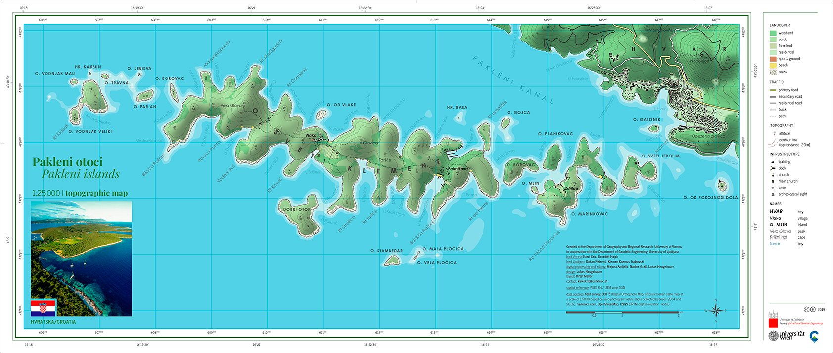
Topography Map
Perfect for exploring the islands on foot, the topographic map shows all the relevant details you need for getting around: contour lines at a equidistance of 20 meters, elevation points, landcover, paths (all surveyed in the field) and important landmarks.
Editors: Mirjana Anđelić, Nadine Graß, Lukas Neugebauer
Download topograhic map as png or high resolution pdf.
Download group reflection.
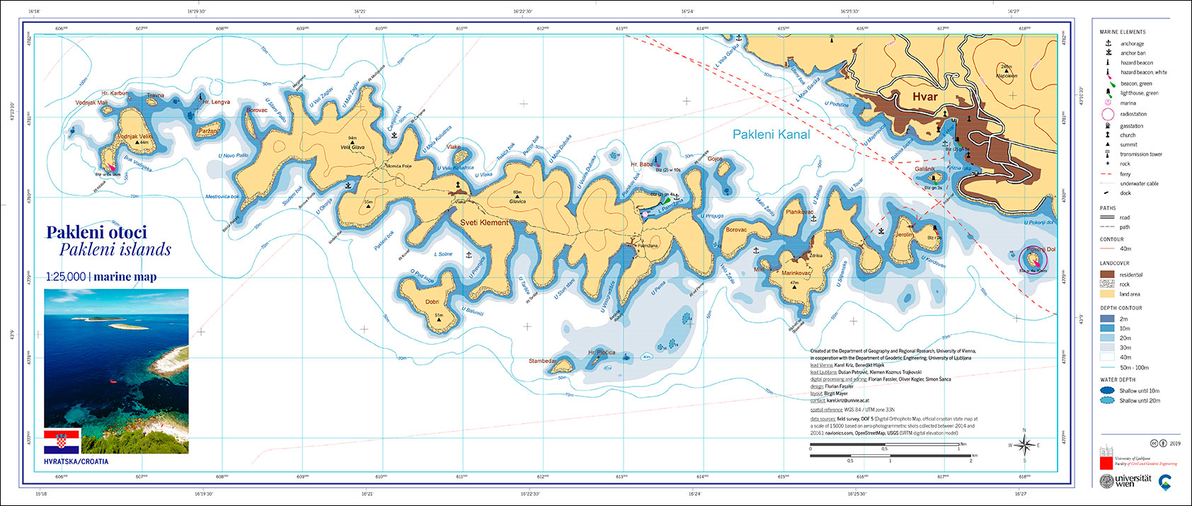
Marine Map
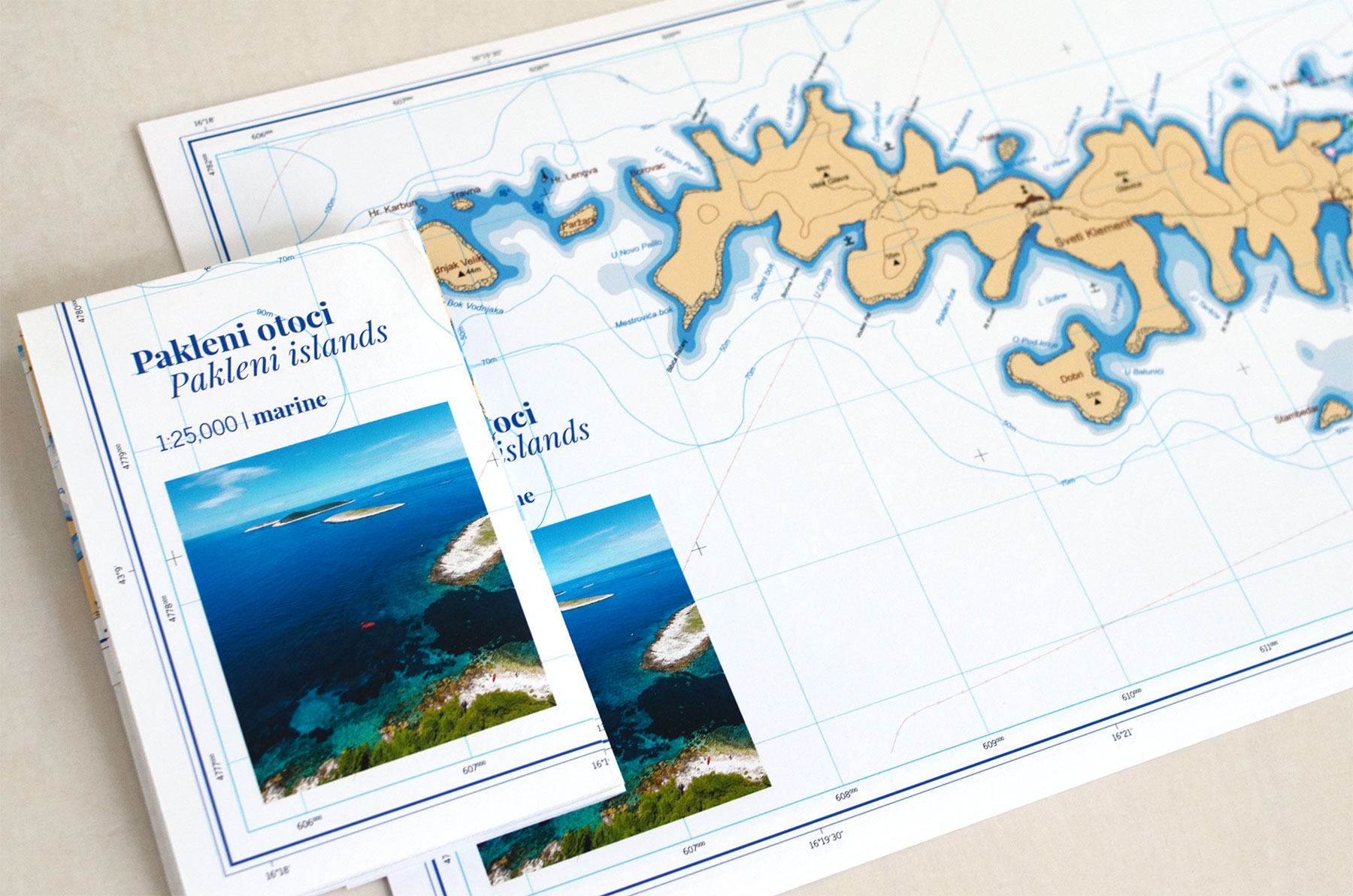
The marine map is optimised for safe navigation on the water. It shows anchorage points and bans, hazards, ferry lines, underwater cables and important land features for orientation.
Editors: Florian Fassler, Oliver Kogler, Simon Šanca
Download topograhic map as png or high resolution pdf.
Download group reflection.
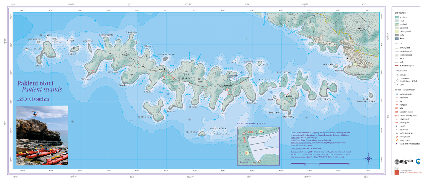
Tourism Map

The tourism map helps you find the best spots on the islands: beautiful beaches, restaurants, viewpoints as well as important landmarks and the paths to get there: all field surveyed of course!
Editors: Giacomo Klopfer, Birgit Mayer, Patricija Vrhovšek
Download topograhic map as png or high resolution pdf.
Download group reflection.