Field work
May 28th – May 31st 2019

Uncharted territory, the parts of the maps that we do not understand. In cartographers’s language they call these places sleeping beauties. Maps and charts codify the miracle of existence and allow us to make smarter decisions. What started out as a simple university field trip quickly turned out to be a wonderful working experience by a multicultural group of students and professors. Working and learning, planning, discussing the results and a little bit of relaxing was the key for our success on the Joint Field Trip to the Pakleni Islands in Croatia.
Day 1 – Arriving at Hvar, kayak trip to the Pakleni Islands
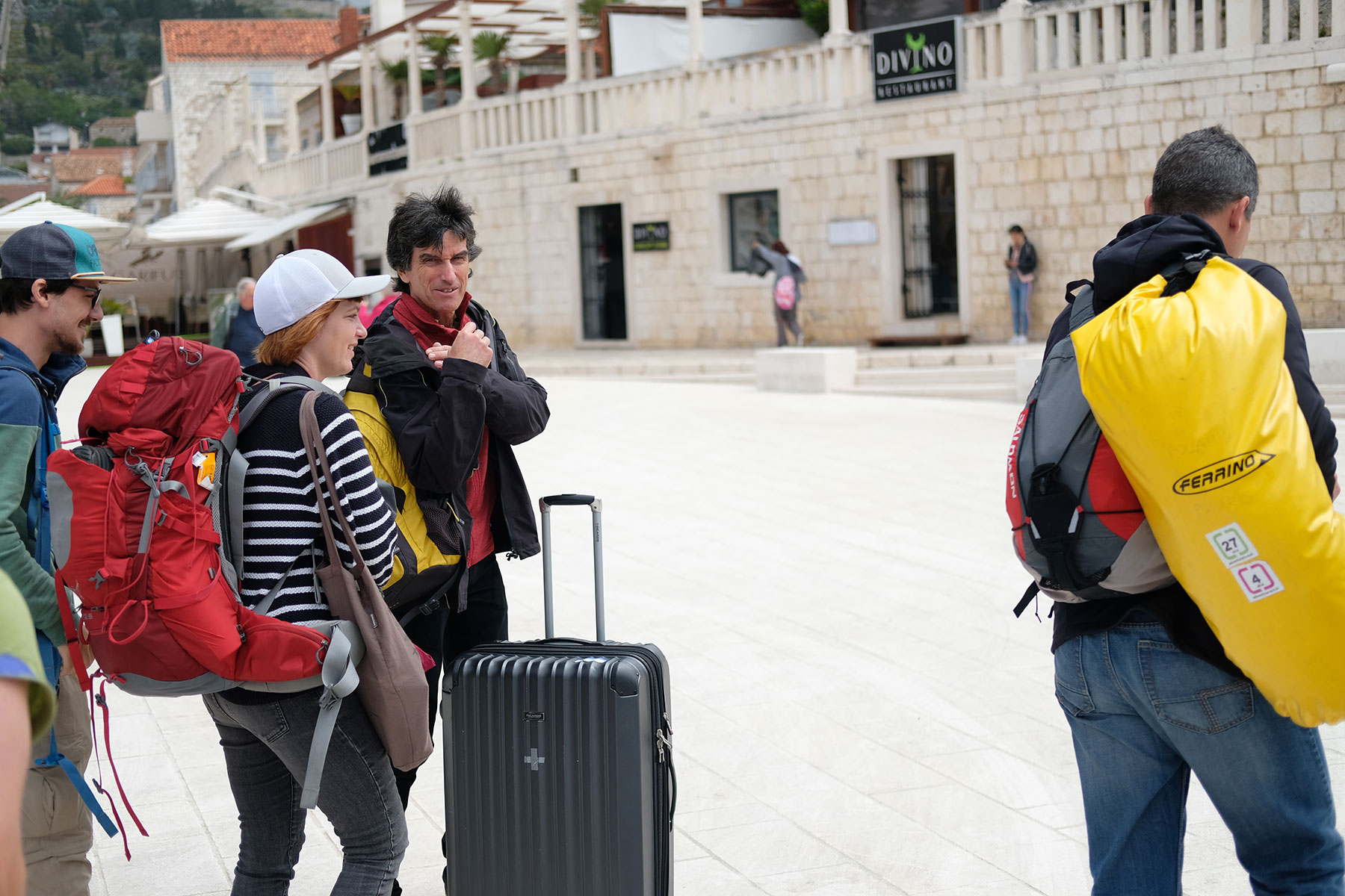
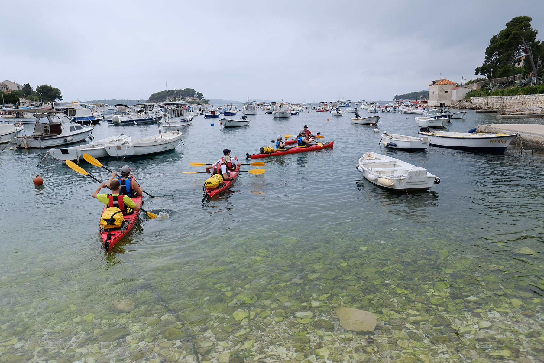
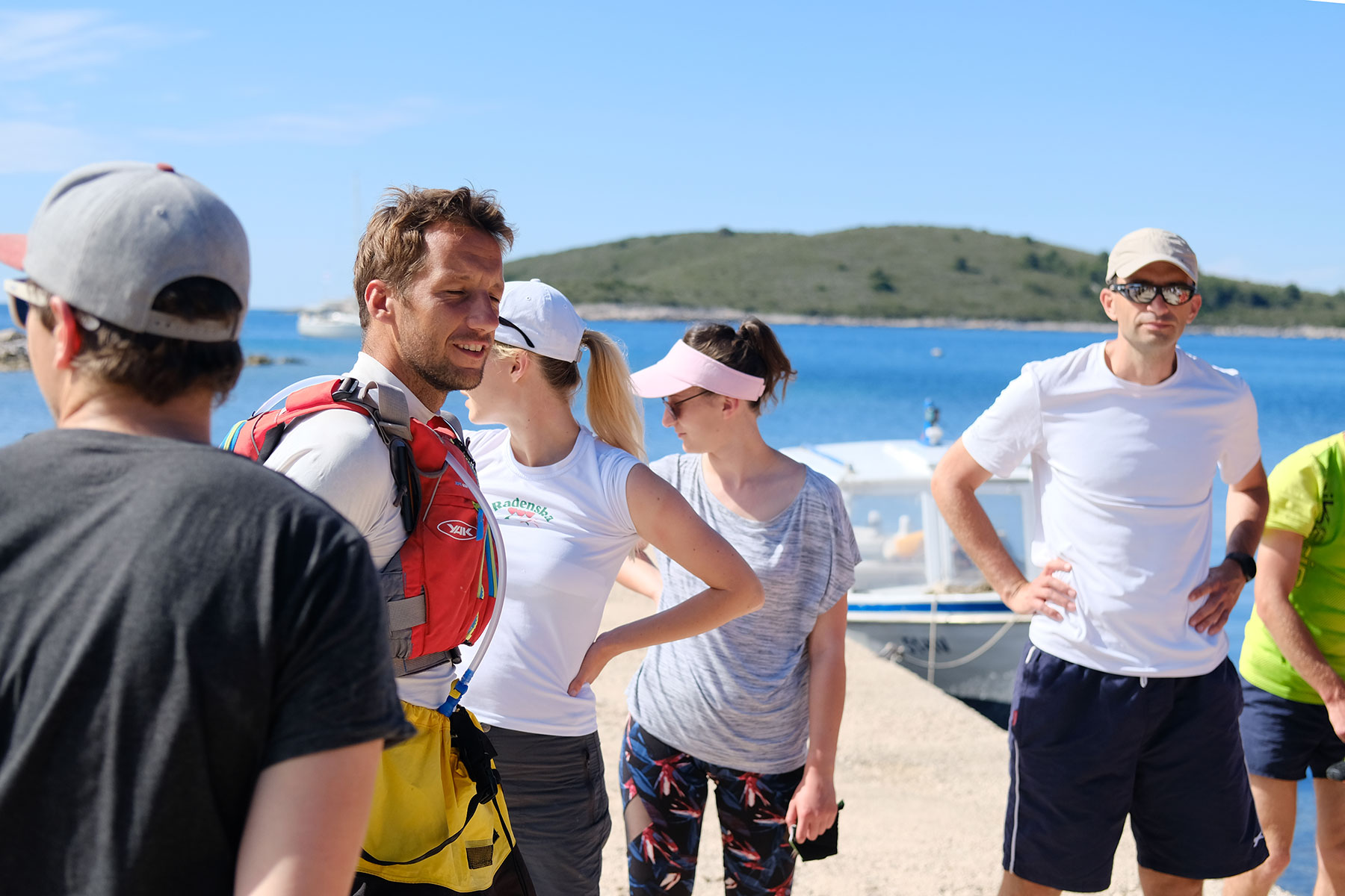
We left the hostel in Split at 8:45 AM to hop on our ferry to Hvar. That’s where we gathered our first geodata by starting the tracking on our GPS device – unfortunately a little bit late. Around 11 AM we arrived in Hvar and were greeted by Marko, our guide for the next few days. After repacking our luggage Marko gave us a short introduction to kayaking and off with the waves we went in our two seat kayaks.
The weather was better than we had expected, partly cloudy and only a little bit of wind. We made our first stop in Ždrilca on Marinkovac islet. That’s one of the things we learned on our trip there: Only Sveti Klement is an island, the rest of the Pakleni islands are actually islets or rocks.
The sun came out and we started to really appreciate this beautiful place. After the short break we continued our journey to Sveti Klement, more precisely to Vlaka, our new home for the coming days. We arrived in Vlaka around 16:30 in perfect weather to go for a swim before checking in into our rooms. After a delicious dinner we had a team meeting and discussed our goals and plans for the next couple of days. We checked some weather sites (windy.com, meteoblue.com, meteo.hr, yr.no) to decide where to go when and how. Planning and checking the weather is urgent on a field trip, because every present plan is based on a future prediction, we always have to take that into account. A decision was reached to spend the following day surveying Sveti Klement on foot, due to the wind forecast. We planned to split into two groups to be able to cover the whole island. One group would explore the western part of the island, the other one the eastern part. When we got back to our house, there was a clear night sky and we finished this intense and eventful day with a glass of vine on our terrace smiling with the moon and our new friends.
Day 2 – Hiking the eastern and western part of the island

Because of the windy weather forecast we decided to hike the island instead of kayaking it near the coast. We split up into two groups:
- topographic mapping and
- tourism mapping.
According to the groups main area of interest the tourism group went east, where we suspected more tourist attractions and the topographic group went west to find a way to the highest point of the island. The marine group supported both other groups.
The goals for the day:
- to check the hiking trails around the island
- to check the elevation points
- to pinpoint or measure the location of tourist attractions
- to explore the coast, the beaches and the possibilities for docking boats and smaller ships
- to check points of interests of the area – restaurants, church, historical sites, graves, wells, old damaged houses
- to check the accuracy of the tourist and topographic map in general
- to drone survey the area
Western part of Sveti Klement
The official trail from OSM was generally very good, the points of elevation were also very accurate, except for the highest peak with about 3m difference to our map. The houses were all in the right place, also the church and other buildings in the western part. The main trail was easy to find, as it is marked by a blue color.
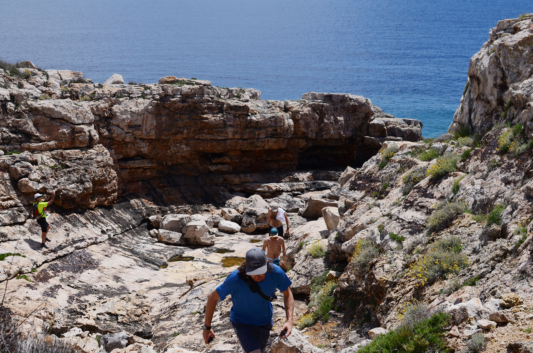
The way to the highest peak was quite difficult, because the path depicted on our maps didn’t exist. Luckily we met two older men from Germany who were about to prepare a path by cutting through the bushes. They had already cleared two thirds of the way, so only the last third under the peak was really difficult to walk through. After we had reached the peak Lukas tried to fly the drone. The problem was, that the peak is very flat and a really big area and it was also too windy. Instead he filmed a little bit and made a few pictures, but unfortunately we couldn’t survey anything. We made a few pictures of the smaller islands because the view to the lighthouses was really god, which is important for the marine group.
We then tried to walk the paths depicted on our map down to the sea and found out that most of them are grown over and not easy to walk. The group gathered on a crossroad, we hiked to the peak and checked the southern coast of Vlaka and the marked paths around it. The eastern group told us, that they had found a path which is not on our map, but it is in a private residence so it’s not interesting for us.
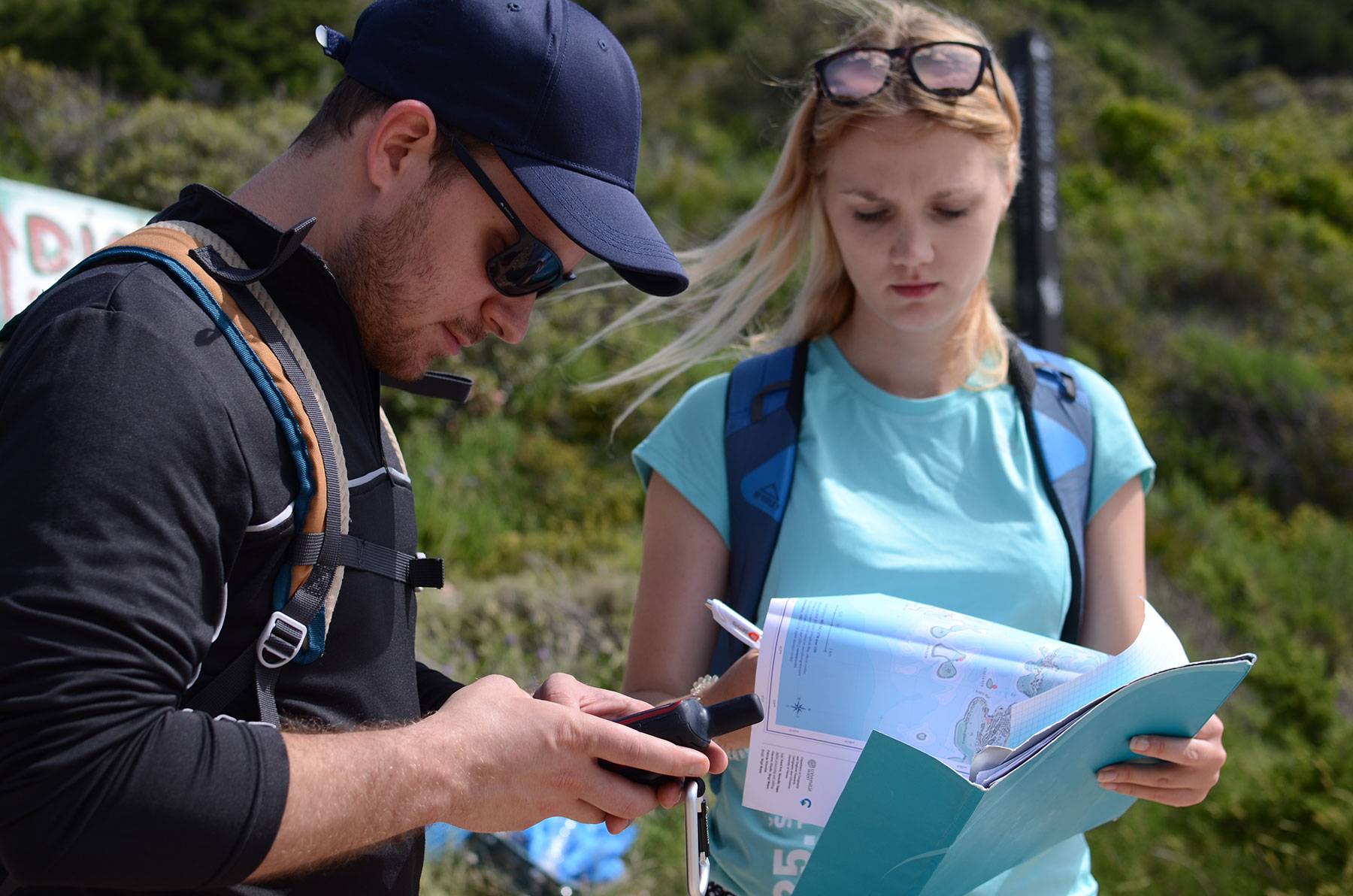
Methods: For the height measurements we used a barometric measurement. In short, a barometer measures atmospheric pressure. This pressure changes as weather systems move through an area, for example storms result in lower barometric pressure and sunnier days in higher barometric pressure. Every smartphone and smartwatch have a barometric sensor, which we used to measure the height of our points of interests. Using Lukas’ Garmin watch we first had to calibrate the barometric sensor. That is why we went to the shore first and after the calibration process we started hiking to our elevation points. We also tried to measure the elevation points with the drone, but with no success.
Eastern part of Sveti Klement
The trail track on the eastern side of the island was mostly recorded, except for some smaller tracks, which lead to the bays on the southern and northern side of the island. In Palmižana we found a couple of interesting spots for tourists, which we had not depicted yet. There are two little markets, ATM-s, a laundry room, a playground and a fitness park. Because the tourist information is so dense in Palmižana we thought about adding an insert map with a larger scale to our map.
We also observed some beautiful viewpoints and went down to all the accessible beaches to assess their attractiveness from a touristic point of view.
The marine data quality is generally well mapped. Almost all areas on the southern and northern side of the island are accessible by kayaks or smaller ships. We had not had good and detailed data considering the smaller bays on the islands. That is why we did a more complex research on the bays. Acquiring precise depth information is a problem, because we do not have the time to measure the bays and the depth with sonars in general. Here we rely on OpenSeaMap and Navionics depth information, which was already in our marine map. The least we could do was to check the depth by the shore by diving the paddle under water. For the purpose of marine mapping we visited the beaches on the southern side and documented them with photographs and text. We were mostly interested in the accessibility of the beaches by smaller ships or kayaks and their characteristics.
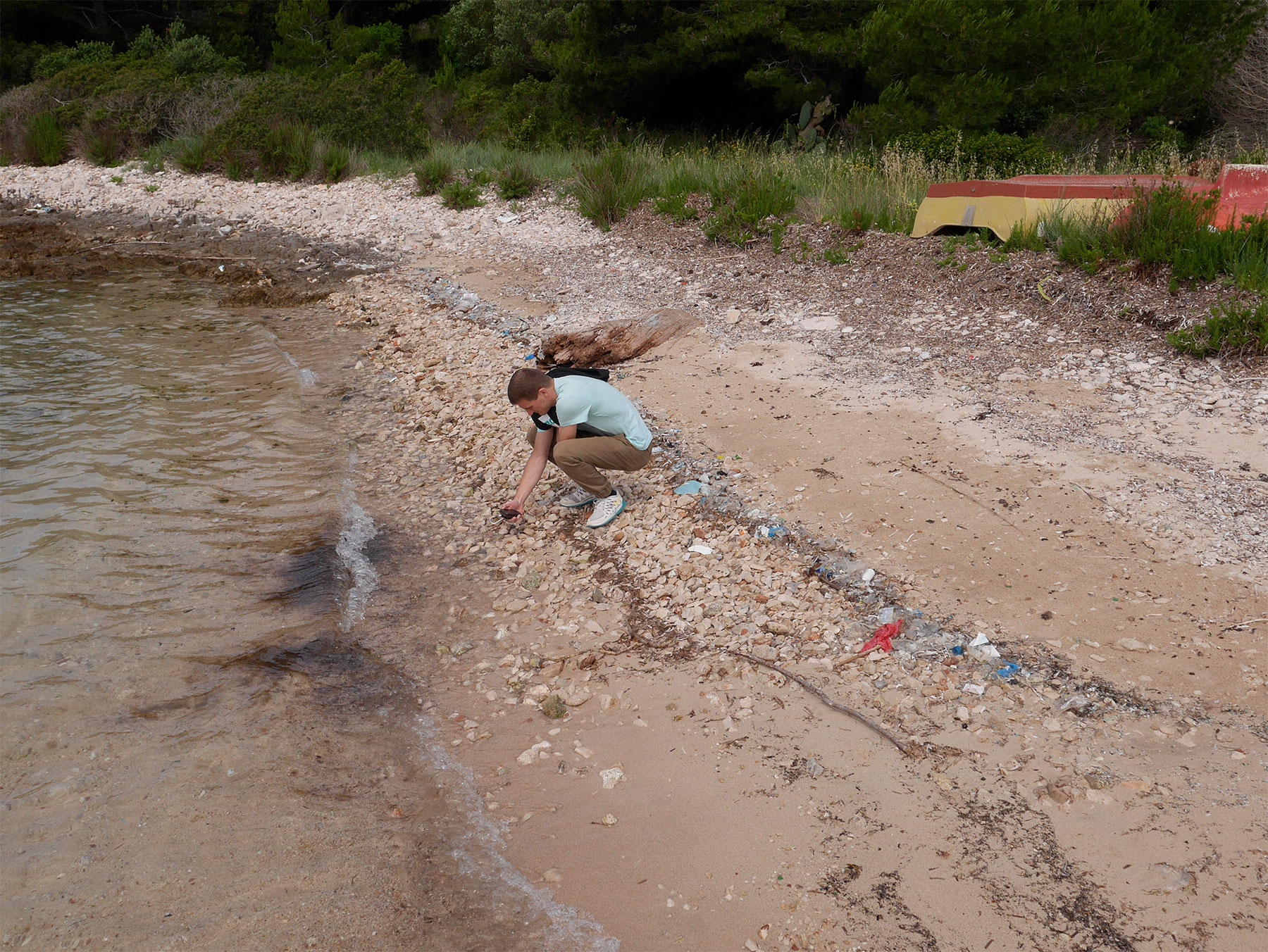
The first bay that we visited was U. Taršće, a small beach surrounded by rocky shore. It has a smaller shore in total length of 25 meters. The shore is accessible by kayaks or by smaller ships. The water is shallow and not deep. The second bay was D. Bok consisting of two shores on the left and right side, both suitable for kayak and small ship docking. On the left side of the bay there are 3 wooden scaffolds in the making, two of them are suitable for small ship docking. There are some steep rocks under water, which make the coast unreachable for bigger ships or boats. We also visited Velika Duboka on the northern side of the island. It is a small bay not suitable for any kind of water transportation except kayaks. The coast is shallow and rocky, but remotely beautiful. It is a calm place suitable for privacy. U. Vinogradišče is the widest and the biggest bay on the island, there is a sandy beach on the left side of the island. Additionally, there are four small piers, where bigger ships can be docked. The area is also very suitable for tourism, it offers some good swimming locations and some good restaurants. At the easternmost part of the island we examined U. Perna bay. It is wide and wild in windy weather. On the shore there is a lot of plastic waste coming from the open sea. We flew the drone here and made some pictures and recorded the marked hiking track.

Results
- The marked hiking trail is good and accurately depicted in the maps.
- The measured elevations points are accurate around ± 2 m.
- We found a lot of spots for tourists, which were not yet in the tourist map like ATM’s, minimarkets, restaurants etc.
- The conclusion about the beaches is that not every beach is reachable by foot, on some parts of the island the vegetation is to dense and hard to cross.
- We improved the name database with the help of the inhabitants of the island
In the end we had a lot of new geodata, were surprised about the volunteers who maintain the paths and that the accuracy of the elevation points is surprisingly good. On the eastern side it was surprising that there is a lot more infrastructure than we had thought before our visit.
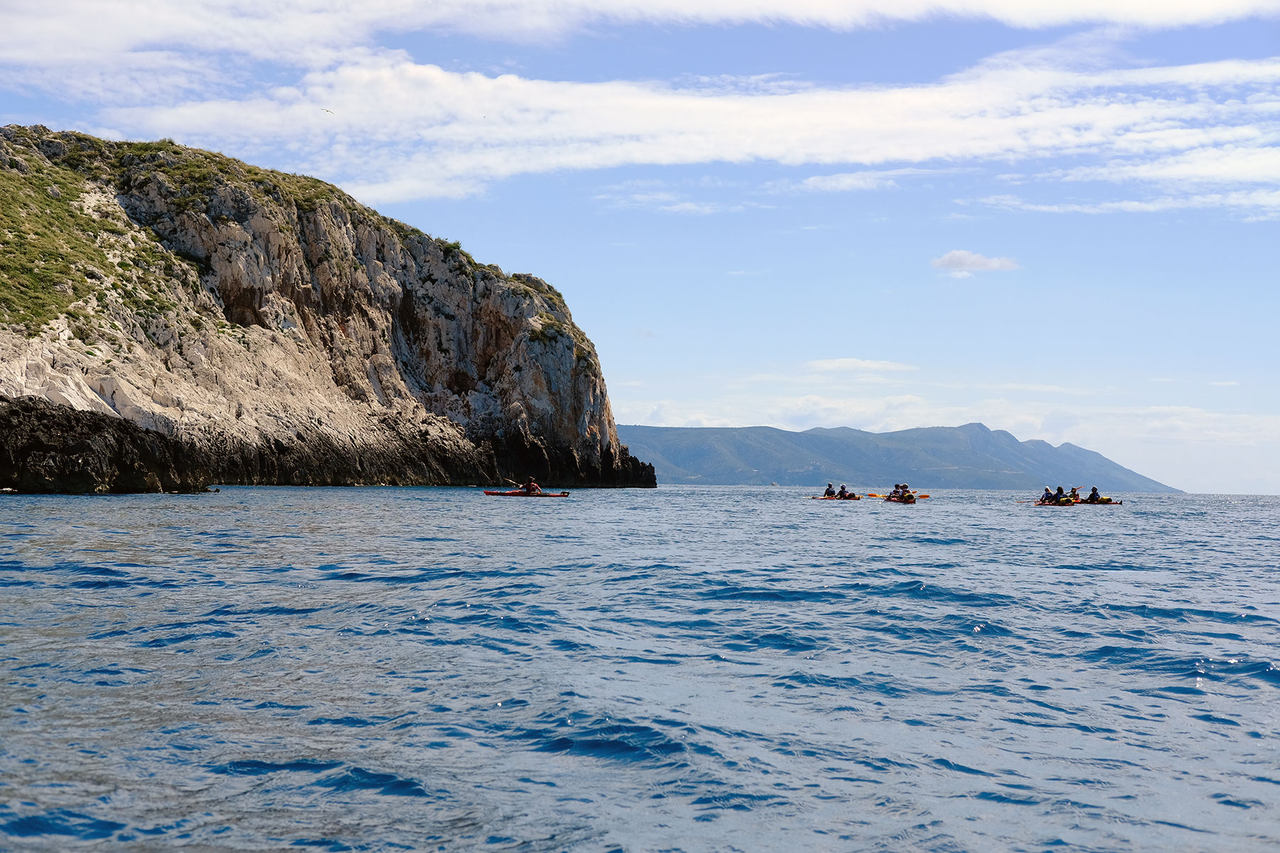
Day 3 – Kayaking around Pakleni Islands, exploring the northern, western and southern coasts, returning to Vlaka from the south
The day started as usual with a good breakfast. After that we had a short briefing, where we discussed our plan for the day, which we had agreed on the day before. Focusing on the weather forecasts we optimized our plans depending on them. Actually the weather was much better than expected. The forecast said that it would be cloudy in the morning with a 30 % chance of rain, but we had sunny weather with a 5 knot NW wind. The plan was to take a trip with the Kayaks to the western part of the island and examine the smaller islands on the west and then visit the southern part, surveying two caves located there. Area exploration characteristics were different depending on the group. For example, the tourism-map team was searching for beautiful beaches for swimming, the marine-map team was interested in finding docks suitable for smaller boats, kayaks and also shallow rocky shores not suitable for sailing.
The goals for the day:
- check all the nautical points of interests - lighthouses, beacons, anchor bans, underwater cable spots, etc.
- check the small spot in the west, if possible to reach with the kayaks
- explore the area; check out beaches suitable for tourists
- get an overview of the vegetation and its density near the visited coast
The objective of the tourism-map group was the search for beaches well suited for swimming, accessible places and caves. Like we expected, we found some small beaches in the various bays of the island, which are only accessible by water. A special access point is a small bay in the southwest of the island accessible for multiple kayaks and sheltered by a rock formation, where it is possible to explore the surrounding area on foot. While the eastern part of Sveti Klement is more touristy, the western part of the island is more adequate and interesting for kayaking. As the beaches are not accessible by land, privacy is granted for those who reach them by water.
The topographic-map group was mostly interested in the existing paths on the western side, the landcover around the coast and the accessibility of the coast by foot. As mentioned above most of the remote western coast is not accessible by foot, the landcover near the coast is mostly heavy bush. The shores are rocky and steep.
For the marine-map group this was the most exciting day. We had to checked all the nautical points of interest and assess the quality of our mapped data with the actual situation in the field.
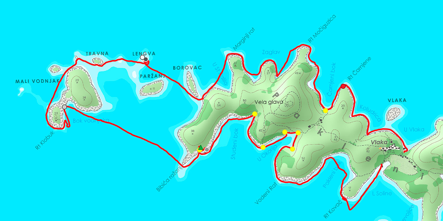
The first surprise was, that there is an anchor ban in Carnjeni bok, we had not mapped. Furthermore, we acquired the real spot of the underwater cable with the help of our GPS device. We further examined the connection between Sveti Klement and Borovac. In our opinion, sailing through is possible with a smaller boat and with kayaks. There were no rocks around the passage and the depth is around 2-3 meters. We tried to touch the bottom of the sea with our paddle, but were not successful. That means that the depth must be around 2-3 meters. Small boats could pass through with no problems.
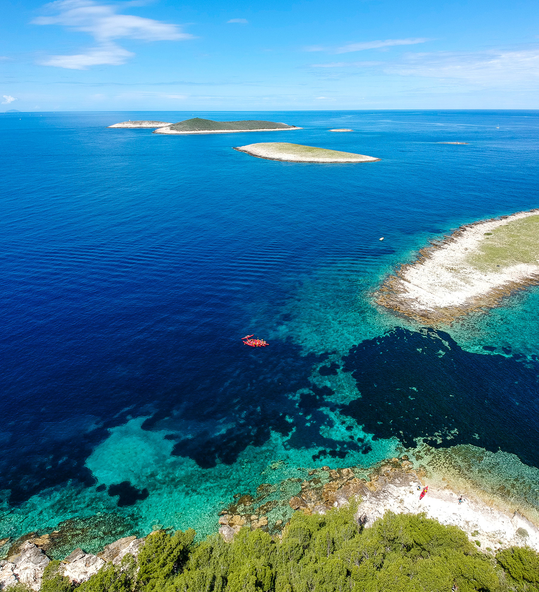
After that we paddled our way to the west around the beacon on Lengva islet, which was already mapped. We then crossed the passage between Travna and Vodnjak veliki. Travna is rocky and inhabited by seagulls, while the bigger islet Vodnjak veliki is inhabited by goats and sheep. Therefore, we assume that it must have fresh water, which is necessary for small cattle like sheep and goats. At the islet, we also met and person and greeted him with a smile. Vodnjak mali, the small islet in the west next to Vodnjak veliki, is small, rocky and unreachable. We kayaked the western and southern coast of Vodnjak veliki and straight to cape Bibića ražanj, searching for a good place to stop, protecting us from the NW wind.
Just after we had kayaked around the cape we found the perfect place on the southern shore. It was a small opening in the rocky, cliffy coast of the southwestern part of Sveti Klement. There we could safely dock our kayaks, go for a swim and explore the island by foot. We searched for two caves, one located on the east and one on the west side of our small opening. The exploration was hard due to heavy vegetation and sharp rocks, but we managed to find two smaller caves on the western side and Marko found the other one buried inside bushes on the eastern side of our opening. All three positions were marked with the GPS devices.

We continued our trip back to Vlaka, passing Studeni bok, U Okorija and Pakleni bok. East of Rt Kovač we finally reached our destination of Soline beach, to walk back to Vlaka from there. At U Okorija, we checked the spot for the other underwater cable and surveyed it with our GPS device. We now successfully have all positions of the underwater cables. Our trip for the day was a success, because the weather allowed us to visit everything we had planned.
After safely docking the kayaks, we had a short break and then carried on with our work: We had to map the GPS tracks, write down the documentation, check the weather forecast for tomorrow and plan the last day and our trip back to Hvar. We discussed our plans after a delicious supper, eating freshly caught grilled fish with potatoes and washing it down with delicious local wine from the Sveti Klement vineyard. We spent some time on Vlaka beach under the clear night sky, before going to sleep after a good day of work.
Results
- We found and mapped several secluded beaches.
- We found and mapped the caves we were looking for.
- We checked and corrected all the nautical points in our map.
- We checked the passages between the islands, to see if they are navigable.
Day 4 – Kayaking the remaining southern shore of Pakleni islands, exploring Marinkovac and returning to Hvar
This was our last day in island paradise, so we decided to enjoy it to the fullest while doing the remaining work. Every trip has and ending and ours began with packing and enjoying our last breakfast on the island. After breakfast we met at the Soline beach, where we had left our kayaks the previous day. We had a short briefing, discussing the weather and the course of our kayak trip back to Hvar. The main part of our trip had already been planned the previous day, we just optimized it regarding the weather and discussed the option of kayaking around the two southern islets Stambedar and Plocice.
The goals for the day:
- to explore the area, check the availability of beaches suitable for tourists
- to explore the southern coast from the kayaks
- to make a quick stop at Palmižana and examine the bay from the kayaks
- to explore Marinkovac and assess the quality of the already mapped paths
- to survey new GPS tracks at Marinkovac and relax a little bit
- to experience the open sea and the stronger waves
- to return safely back to Hvar
We departed from Sveti Klement around 9.30 and kayaked our way to the south with the help of the NW wind in our backs. The southern shores of Sveti Klement were already examined on Wednesday, so we did not visit them with our kayaks. We kayaked close by Dobri otok and travelled straight to Stambedar, an islet with high cliffs unreachable to anyone except seagulls. The marine-map team examined the rocky shores of the smaller islet Plocice, which is just a bunch of rocks. The shore around is shallow and rocky. There are no beacons around the area, which makes navigation at night more difficult.
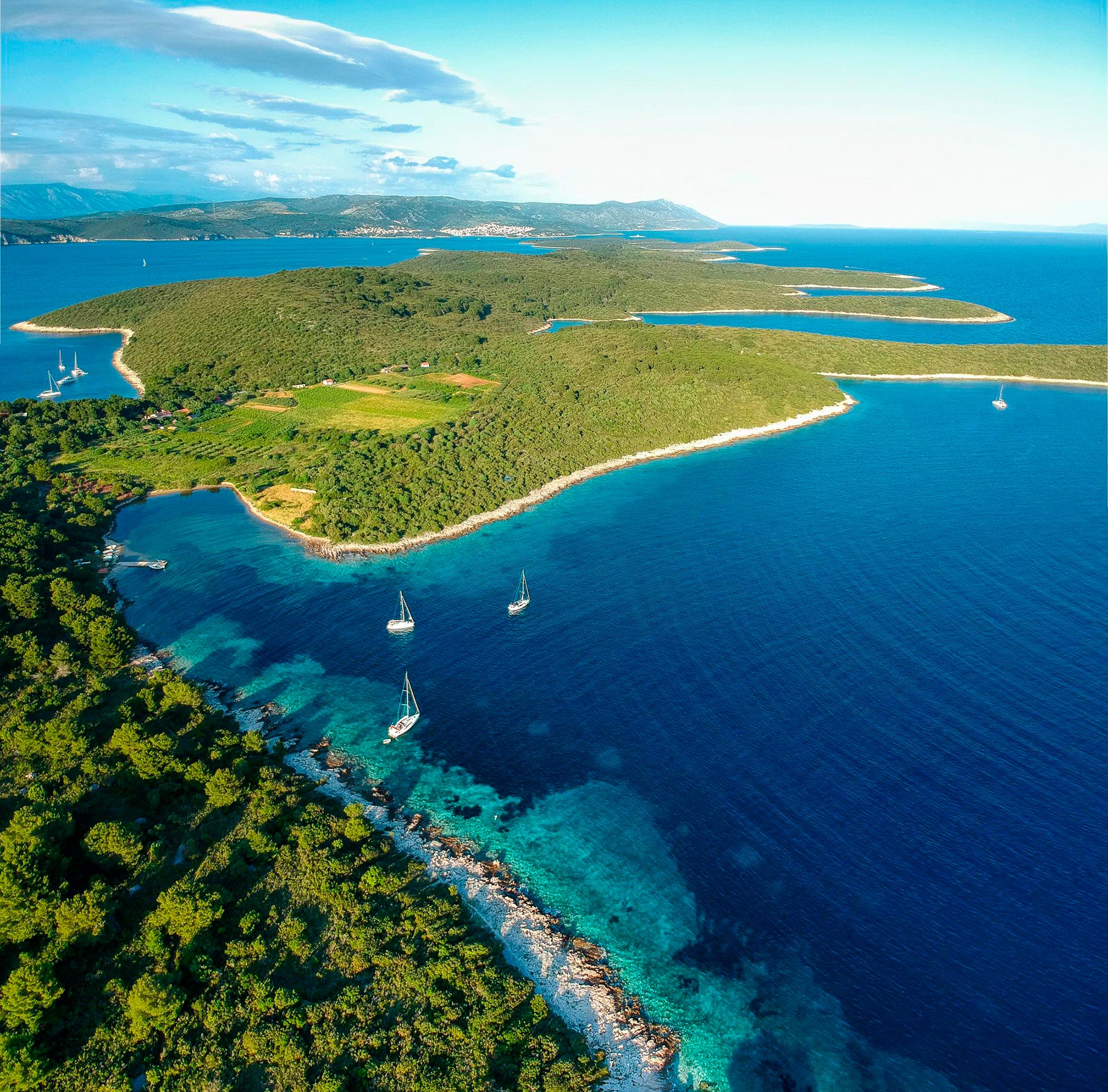
Our next stop was the touristic beach Palmižana and the U Vinogradišče bay. We kayaked both sides of the bay, which is suitable for bigger boats. There are four piers located there, where boats can be docked. Palmižana is a beautiful place, it has a sandy beach suitable for tourism, offers some restaurants etc. It is also protected from N, E and W winds. We decided not to leave our kayaks in Palmižana, because we had already checked the area on foot and just made a quick break floating with our kayaks and enjoying the simple pleasure of being one with the sea.
We continued our trip near cape Rožanj and visted U Perna bay, which was polluted with mostly plastic waste. The waste floats and travels north with the southern wind and accumulates at U Perna bay.
The hiking paths had already been mapped on Wednesday, so we had nothing more to examine here. We kayaked our way near the coast around cape Perna and went straight to Marinkovac, more precisely to Ždrilca. On our way there, we passed the islet Borovac. There is a lot of sea traffic on this part of the sea, so kayakers need to be fast when crossing.
We finally arrived at Ždrlica and parked our kayaks safely at the beach and had two hours left to explore Marinkovac. We split up into three groups. One group explored the western part of the islet, one the center and the third one the eastern part. Our main focus was to assess the quality of the marked paths of the islet and find new ones that were not yet included in our maps.
Marinkovac is a beautiful place. We learned that there is nightlife going on at the Carpe Diem club located in the eastern part of the islet. Ždrilica bay is also suitable for smaller ship docking and has three restaurants which offer accommodation. There is also a ship ramp which was not mapped on our chart and maps. We recorded new GPS tracks which will be added to our maps at home. In the end we had plenty of time to have a proper dinner, swim and also practice the eskimo roll with the kayaks. The eskimo roll is not as easy as it seems, especially in a double kayak where two people have to be synchronized in order to be successful.
The wind grew stronger and changed its direction to NW. At 14.00, we had a group meeting where we discussed our results and our way back to Hvar. We decided that we would take the southern route back to Hvar. That option was the best, because we would explore the southern shore of Marinkovac and be protected from the stronger wind.
We left Marinkovac, kayaked our way near the western shore to cape Ražnjič and went straight to islet Jerolim. We had the opportunity to experience the open sea from Jerolim to the Gališnik islet. The waves were vast and the kayaks jumped with the waves. In order to move ahead, we had to paddle fast and strong. It was an amazing experience. Everyone was wet and salty in the end. From Gališnik, we kayaked straight into the bay in Hvar, where everything had started on Tuesday. We celebrated our arrival with a cold shower and repacking our luggage and thanked Marko for his amazing guidance and wished him a safe return back home.

Results
- We ckecked out the southern islets from the sea.
- We checked the paths and touristic spots on Marinkovac.
- We kayaked around the southern shores of Marinkovac and Jerolim and mapped the beaches there.
- We discussed the tasks, that still needed to be done (updating the maps, uploading all the gathered data to OSM, documentation) and agreed on an agenda.
- We improved our kayak skills.